Sunday, August 23, 2009

Vashon Challenge Race-Aug 22

WARNING: This post only contains sailing info. Those looking for motorcycling, bicycling, hiking or other non-sailing related activities may be disappointed.

The Vashon Challenge Race is a singlehanded/doublehanded race around Vashon Island in a clockwise direction. My plan was to race in the singlehanded division. There were also a doublehanded spinaker division and a doublehanded no flying sails division. It is sponsored by CYC-Tacoma. The distance is 33 NM.

I took the boat to Tacoma on friday. It is a 33NM trip and was somewhat uneventful except for the grey skies and a light sprinkle of rain a couple times. I moored at Dock Street Marina in the Foss Waterway right in front of the Museum of Glass. That area of Tacoma has really been cleaned up and is quite the tourist area. I played tourist and visited some stores.

After a quiet night and an early morning breakfast at the Renassaince Cafe, I was underway at 0838 for the 1005 start off Browns Point on the east side of Commencement Bay. The sun was out and the temperature warm. The winds were in the 5 knot range out of the NW and like most of the other competitors I headed toward the west side of Commencement Bay and short tacked up that shore toward Pt Defiance. As the current was ebbing, this seemed to be the fastest route. Since the current always flows north in Colvos Pass, the trick is to find the right curent lane thru Dalco Pass and into the river flowing north. The wind built to about 10 knots from the north. This made for a nice beat up Colvos Pass to the turning mark set north of Vashon Island.

The spinaker run down the East Side of Vashon Island was fast even though the current was still ebbing. I past a couple of the no flying sails boats that started ahead of me. This year the course used a buoy just SW of Pt Robinson. This buoy was to be left to port and was in case the race needed to be shortened. It was a very tight spinaker reach to leave the buoy to port and at least one boat ahead of me did not go around the buoy and dropped out when he was aware of his mistake(which was several miles downwind of the buoy).

The remaining of the run was light and at first I closed with some boats ahead, but could not catch them. I was the 6th boat to finish at 1602. I am sure that at least a few boats behind may have corrected on me.

Results when the are posted can be found on: http://www.cyct.com/racing.html

Following the finish I immediately motored home, arriving at the marina at 2011. It was a pretty uneventful delivery except the wind blew strong down Colvos Pass making it a bit cool. And I also had to wait until I was closer to home (and the wind moderated)to fold the main.

Total distance for the weekend: 100.4 miles(nautical not statute).

The light winds before the start.

Gardyloo, a Henderson 30 in the doublehanded division looking good on the run.

Running downwind toward Pt Robinson.


More spinakers on the run.

The track for the day. We started and finished just south of Browns Pt on the east side of Commencement Bay.
I have been getting better at converting the track into a format that I can put into this blog. The quality will probably never be very good with the scanned charts used on the boats nav computer. But I think it is a good visual. I can count the number of tacks(17) and jibes(5). The cool thing is that you can see the effect of the north flowing current in Colvos Pass, the angle of the tacks is far less than 90 degrees. As long as the computer continues to work and I remember to start the track I will continue to record this info.

Wednesday, August 19, 2009

Motorcycle Ride To Hurricane Ridge.......well, maybe not.

WARNING: This post only contains information on Motorcycle riding and hiking. Those looking for sailing info will be dissapointed.


Today my plan was to ride the motorcycle to Hurricane Ridge and go for a short hike. I loaded the hiking gear on the bike and was underway at 0645. The ride was excellant. Today was suppose to be hot, but along the north coast between Port Townsend and Port Angeles, the temp was kept cool by the proximaty to the Strait of Juan de Fuca.

When I got to the visitors center at Port Angeles, the sign said that the road to Hurricane Ridge was closed. Evidently there was a slide that closed the road and it "could" be open by midday.

Well, time for Plan "B". So I decided to continue on to Sol Duc and do some hiking there. The ride then continued along the shore of Crescent Lake. This has some nice corners and there was no traffic going my way.

At Sol Duc, I hiked the four miles to Deer Lake. This is not a real strenuos hike and only climbs 1500 feet. Later this fall I may hike this again, but continue around the High Divide Loop. That will only be about 18.9 miles with about 4000 feet of climbing. I did feel a lot better doing this eight miles than I did doing the six miles last week on Mt Ranier. It was hot and did not cool down again until I got to Port Angeles. Then it got hotter near home.

Motorcycle Distance: 234.2 miles

Hiking Distance: 8 miles

Sol Duc Falls, not much waterflowing!
Deer Lake at 3500 ft.

Tuesday, August 18, 2009

Hedges and Lava Rock

WARNING: There is very little mention of sailing or motorcycle riding in this post!


For a couple of weeks I noticed a sign in front of a house on a side street that said: "Free-Lava Rock". There did not appear to be much left, but yesterday I went to the house and scrapped up a small truck load. Definatly more than it looked on the ground. It was dirty, but mainly mixed with sand. The lady that lived there took my number and said that there was more in the back yard and would call me when it was available.

I hauled it home and built up several inches of it along the garage. The previous owner also had put lava rock there, but such a thin layer that it was sinking into the dirt beneath it. Some of it also went into the landscape area on the other side of the driveway. If I get more of it I will be able to expand the coverage area along the driveway.

Then today, I spent several hours trimming the hedge. I have been putting this off for some time. First it was too hot, then too wet. Today was warm, but I started early before it got too hot. Now I have a large pile of clippings to run thru the chipper/shredder.


Lava rock along the garage. Dirty, but should clean up when it rains.
Almost finished with trimming the hedge.


Now some other stuff.

I am headed off on friday to Tacoma for the Vashon Challenge Race. This is a sailboat race around Vashon Island. This is a singlehanded/doublehanded event that I have always raced singlehanded. It will be a nice outing. I have reservations for Friday night at the Dock Street Marina that is on the Foss waterway right in front of the glass museum.

Tomorrow I am thinking about taking a motorcycle trip to Hurricane Ridge to go hiking. Suppose to be a nice day.

Saturday, August 15, 2009

IT'S A BOY!

It's A BOY!

Name: Burrito

Adopted: August 15, 2009

Age: 5 months

Weight: 4 lbs

Coloring: Orange/white tabby

Other: Fun loving, playful.


Wednesday, August 12, 2009

One Year

It has been one year since I started this blog. Since I put a counter on it, I have been recording 6-12 hits per day, some are people that stumble onto this blog without looking for it. Most people that look at it are regulars.

I have viewed a lot of blogs over the last year and read many on a daily basis. There seems to be quite a variety of styles that people use. Some are travel logs. Some are daily occurences. Some are deep philosophical writings. One strives to be a technical class on how to do things. One friend posts numerous pictures of his cooking each week.

My main objective was to write about what I am doing while I am a retired person. It is as much for me to record(and remember) items as it is to let others know what I am doing. I guess I feel that a blog is somewhat self centered. Obviously I write about what "I" am doing. And for that reason, I often think about not doing this anymore. Why should I write about "me"? I always thought that being on the road and reporting a travel log would be a good way to keep family and friends involved. I enjoy those blogs the most, almost real time. Following someone across country or across oceans is thrilling to me.

I have joined Facebook, but that has not been as satisfying, I like blogging better.

So, for the time being, I will try to keep writing. Feedback is important to me. Anyone have comments?

Sunday, August 9, 2009

Shaw Island Classic Race

The Shaw Island Classic was a sailboat race on August 8th that started at Friday Harbor on San Juan Island, goes around Shaw Island and returns to Friday Harbor. This race usually attracts a large number of boats and since it is run in the middle of the summer, a lot of boats combine this race with cruising the San Juans. I have always wanted to race this race and a couple of weeks ago I submitted my application and the friendly people of the Port of Friday Harbor were able to assign me one of the last slips available to moor for Friday night. I decided to make a quick trip of it and deliver the boat to Friday Harbor on Friday, race Saturday and return home Sunday.

I got underway at 0604 on Friday morning. The currents were fantastic and were with me almost the entire way. The sky was overcast and the wind nonexistent. I motored all the way. When I got to Friday harbor at 1425, the sun came out and it was a pleasant day. The 8 hour 21 minute time from Brownsville to Friday Harbor is probably the fastest I have ever done. Good planning on the currents helped. It is 63 nautical miles to Friday Harbor.

On Saturday, the race started at 1200. The rules for the race allow competitors to select the direction they want to round Shaw Island. The currents are the biggest factor. Most boats chose to round in a clockwise direction. The race started just outside the harbor entrance but still somewhat in the lee of Browns Island. There was wind in the harbor and wind in San Juan Channel, but not much on the starting line. The yacht club starts all classes together and there were 69 boats on the line for the start! I was racing in PHRF A class. There was 7 other classes for multihulls, cruisers and slower PHRF(Pacific Handicap Racing Fleet) boats. It truly is a race where "you race what you brought".

I got an average start at the north end of the line. My thoughts were that with the current ebbing initially, I could go low, catch the wind in the channel and the current would carry me right. The plan worked well. The wind was about 10 knots. I made good time to Upright Channel and set the spinaker. I stayed close to the Shaw Island Shore for current relief from the still ebbing current and passed a lot of boats. By the time we reached the east end of Shaw Island, the current was starting to flood, but the land was blanketing the wind. I caught up to the leaders, Heart of Gold(Schumacker 50), Grafix(Soveral 33), Tinette(J124) and an Express 37. Spinakers came down and the rest of the course through Harney Channel and Wasp Pass was close reaching. I passed Tinette and Grafix and stayed close to the Express 37. When we sailed out of Wasp Pass and into San Juan Channel, we were fighting the flood current. Myself, Heart of Gold and the Express all short tacked the Shaw Island shore, Grafix went into the middle of the channel. I passed the Express and stayed on the Shaw Island side as did Heart of Gold. The Express went out in the middle with Grafix. When I finally headed across the channel, I was suprised to see that the Express had passed me and Grafix had closed up. The finishing order was: a Hobie catamaran that went clockwise, Heart of Gold, the Express, Graphix and Great White. I finished at 1518 which was considered fast for this race, usually the winds do not cooperate as well. We corrected to 3rd in PHRF A and 13th overall. I was pleased with the result. Total distance sailed was 16.9 miles(nautical not statute).

A few boats went clockwise(mainly against the current) and a couple did well with a Hobie Cat placing first overall and a J80 placing second overall.

The San Juan Island Yacht Club put on a great after race Lasagna dinner and awards presentation. It was a great time to meet up with some of my old sailing friends and to meet some new ones.

Sunday I got underway at 0855. It was slightly foggy in San Juan Channel and got really foggy in the Strait of Juan de Fuca. The radar paid for itself as visibility was less than 1/8 mile. I had numerous targets on the radar to track. I traded horn signals with a whale watching boat before we saw each other. They stopped right in my path. The fog lifted closer to Partridge PT and the sun finally came out. The currents were adverse in the northern half of Admiralty Inlet. The wind came up so I sailed for about 1-1/2 hours, but had to give it up off Kingston when the wind died. I arrived at Brownsville at 1848. Another 63 miles for the day.


Race results can be found on: http://www.sjiyc.com/


Comfortably moored in Friday Harbor on Friday afternoon.

Some of the boats maneuvering before the start.

More pre-start action with the big schooner Barlavento in the foreground. They have a large windshadow and also once moving they can coast for a looong ways! They passed me once during the race with all their sails luffing or aback and I was sailing 5 knots!

Boats behind sailing up Upright Channel.

My track for the race. I went counterclockwise. A "half way" shortened finish line was set up off Blind Bay if we did not finish within the time limit.

Slightly foggy in the Straits!

Wednesday, August 5, 2009

Mt. Rainier

Today, I decided to do a little hiking at Mt Rainier. I loaded the motorcycle with my hiking gear and set out at about 0615 and rode to White River campground near Sunrise on the NE side of Mt Rainier.

From there, I hiked up to Glacier Basin. The basic hike is 6.2 miles round trip, but I continued on the climbers trail for about another 1-1/2 miles to the moraine of the Inter Glacier. This is the route for climbers on their way to the Emmons Glacier route to the summit of Mt Ranier. The weather was clear and warm. The trail was in poor condition for about a mile where it had been washed out during the 2006 floods. In those areas, it was a poorly marked, undeveloped trail that wanders thru the boulders along the banks of the White River.

After I returned to White River campground, I got back on the motorcycle and rode the remaining 10 miles to Sunrise. This is the first time I have been there. I wandered thru the visitors center and walked to the Emmons Glacier Vista and took some pictures of where I was in Glacier Basin.

I was going to continue back home thru Enumclaw on the reverse of the route that I used this morning. But, I found out that Stevens Canyon Road was open. So from Sunrise, I went east on 410, over Cayuse Pass and reentered the Park at Stevens Canyon. This heads up the east side of the mountains to Paradise. The new visitors center was just opened this year, so I wandered thru it and then started for home arriving home at 2000. Total motorcycle miles for the day:271.9 miles.

A strange thing happened on the way up Stevens Canyon road. Something got under the bottom of my full faced helmet and hit me hard on the neck. I stopped and unzipped my jacket but could not find anything under the jacket or in my shirt. About 15 miles later I stopped to take a photo. I reached down to unzip my pocket to get the camera and was hit with stinging pain on the inside of my upper arm. I got off the bike and ripped off the jacket. Sure enough, a bee fell out of the jacket. He must have gotten inside when he hit my neck and found his way over toward my arm. When I moved, he got me twice on the inside of the arm near the armpit. Looked kind of like a bumble bee. Can they bite as well as sting? These hits look more like bites. Oh, he stumbled around in the gravel for a while and then took off! No bees were killed during this incident!

Edit: I found my answer on the bumblebee. From Wikipedia:"a bumblebee's stinger lacks barbs -- so they can sting more than once." This must be what happened to me.


In Glacier Basin looking toward Inter Glacier.
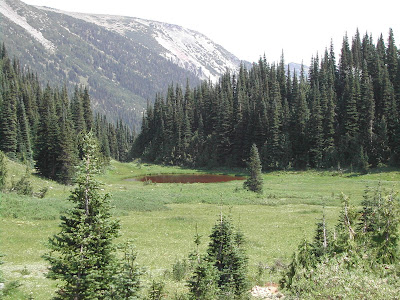
Pond and meadow in Glacier Basin.

Looking up Glacier Basin from Glacier Basin Camp.
White River.
Visitor center at Sunrise.

Mt Rainier from Sunrise. Emmons Glacier flows down the face.

Steamboat Prow, Inter Glacier, Glacier Basin viewed from Sunrise. Glacier Basin is where I hiked into from White River campground.

Mt Rainier above Reflection Lakes.

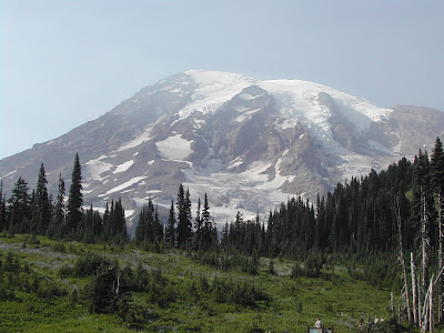
Mt Rainier from Paradise.

New Visitors Center at Paradise.