Way up in the northwest corner of Washington State is Lake Ozette. Lake Ozette lies within the Olympic National Park although some of the shorline is still grandfathered as private land. This part of the park also includes the ocean coast. It is about three miles from the campground on the north end of Lake Ozette to the beach and with two trails leading to the beach and three miles of beach, a nice 9.5 mile hike is possible. I first hiked this loop with my parents nearly 50 years ago and have returned several times since.
It is about 150 miles from my house to Lake Ozette. I chose to ride the motorcycle. After getting underway at about 0500, stopping for gas in Sequim, breakfast in Port Angeles, I arrived at about 0830. I chose to ride Hwy 112 from Port Angeles to Clallam Bay. This has sections that are very winding which was fun as I got to practice my cornering. But it was also really cold in the 40's and by the time I rode the last 25 miles of rough road from Clallam Bay, I was ready to get off the motorcycle and start hiking!
I hiked the south trail to Sand Pt first. It was a clear day and I soon warmed up. The trail is mostly elevated boardwalk. Fortunately it was dry and the trail was not slick. Soon I was on the beach at Sand Pt. The south beach here is very nice and is nice clean sand. I walked north around the point and started up the beach toward Cape Alava. Here the beach is mainly rock and gravel that was also covered in thick blankets of rotting kelp. Part of my reason for this hike was to see how much tsunami debris was on the beach. I was surprised that the beaches were very clean of any debris. Usually there is a lot of junk on the beach. There may have been a cleanup program.
When I reached Cape Alava, I headed inland on the trail that was once again mainly elevated boardwalk, but some areas had been updated with and elevated gravel surface. The Cape Alava trail goes through a couple of meadows that are left over from some early homesteaders.
Back at the trailhead, and I started home. The temperature was a lot warmer, so the ride was a lot more enjoyable. Again I took Hwy 112 and practice some aggressive cornering. After stopping at Sequim for gas again, I was home by 1730.
Map of the trail. The total length of the loop is about 9.5 miles.
Most of the trails are elevated boardwalk.
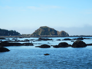
It was a nice sunny day at the beach.
I think this wheel had some help getting up on the stump. This could have been tsunami debris. It was a nice wheel and a newer tire with lots of tread.
The fog burned off as the day warmed up.
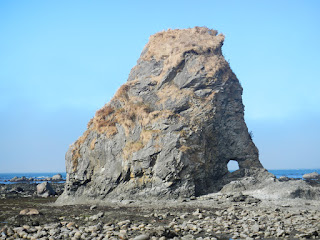
I like this hole in the rock.
The petroglyphs.
This float had Japanese manufacturers marks. But it could have gotten here by many methods. There are always floats on the beaches. This float was huge, about 3 ft long.
One of the meadows where one of the homesteaders lived. The first time I hiked this trail nearly 50 years ago, there was still a house here. The foundation may still exist.


1 comment:
Gorgeous pictures! I liked the tire one especially; pretty funny looking.
Post a Comment