All summer I had wanted to take a few days and go on a road trip for a few days and do some hiking in the Cascade Mountains. But the summer passed by without it happening. One of the hikes I wanted to do was in the Sunrise area of Mount Ranier National Park. I have hiked here a few times and for some time have thought about hiking a loop starting and ending at White River Campground. My plan was to hike from the campground up the Wonderland Trail to Sunrise, across the Burroughs Mountains, down into the White River valley and back to the campground. Since the weather on Thursday was suppose to be the best of the week and Friday was suppose to be stormy, this looked like one of my last chances.
I left my home at 0430 and after a quick breakfast at Enumclaw, I was at the White River Campground and ready to hike at 0739. I started up the Wonderland Trail. I was nervous about this section. Unlike many of the other trails in the area, I had never placed my boots on this trail. As I suspected, it started going uphill from the start. I kept a constant pace and was not very winded. As this trail switch backed up the valley wall, views of Mt Ranier appeared through the fog and clouds. It was 34 degrees when I started, but got colder as I gained elevation. After 1 hour 40 minutes and 1900 feet of elevation, I reached level ground.
I then headed west toward the Burroughs Trail. After passing Shadow Lake, the climb began along the south flank of First Burroughs. It is a steady climb on rocky trails that run along exposed treeless slopes. This area is soon devoid of and forest and a sign says that it is very similar to Arctic tundra. After reaching the top, the trail was covered in a few inches of newer snow. Footprints indicated more hikers in the area and at the trail intersection at 7000 foot elevation, I stopped to talk to one and while I was stopped, several more showed up.
I soon was cold, so I started off for the final climb up to Second Burroughs. This climb always looks worse than it is and I soon found myself on the 7400 foot elevation. The view from here is spectacular! Mt Ranier is in your face to the southwest. Berkeley Park and Sunrise is north and east. White river is a ribbon of flowing water to the south. And Mystic Lake and Spray park is off to the west. An elaborate rock bench was built here, so with a comfortable place facing Mt Ranier, I ate lunch.
After lunch I continued on down the back side of Second Burroughs. The trail was soon covered in about six inches of snow, but it was still easy to follow from the tracks of a couple of hikers. I passed up the way trail to Third Burroughs and continued toward the Glacier Basin trail. The trail soon headed steeply downhill with numerous switch backs and a lot of large rocks to step down off of. As the trail descended, it went from rock to alpine meadows and the woods again.
I soon reached the trail to the White River Campground. A side trip up to Glacier Basin would have been fun, but unfortunately I needed to be home early, so I headed down the gently sloping trail arriving at the camp at 1400 after about 10 miles, 6 hours 20 minutes of hiking and 3200 feet of elevation gain.
This was a fun hike and I finally got over the fear of climbing from White River Campground to Sunrise. In the cold crisp air, the views were awesome. I felt fine afterwards and I knew the beating of my heart and deep breathing was from exercise and not like the panic attack I had a few days earlier.
Here is my route starting and ending at White River Campground heading in a counter clockwise direction.
View of Mt Ranier from the Wonderland Trail.
The first sign. I headed left on the Sunrise Rim Trail towards the Burroughs Mtn Trail.
Where I came from: White River Campground.
Shadow Lake.
Headed right to First Burroughs.
On the climb to First Burroughs, the fog rolled into the valley and at one point put me into a white out.
The rugged trail up First Burroughs.
The exposed flank of First Burroughs.
A little bit of snow on the top.
I headed to the left to Second Burroughs.
Mt Ranier from Second Burroughs.
Looking toward Berkeley Park.
White River where I started the day.
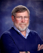
A "selfie" on the summit of Second Burroughs.
The snowy trail heading down the backside of Second Burroughs.
I headed right to Glacier Basin Trail.
The White River again.
I headed right toward the White River Camp.
Just a waterfall along the trail.


No comments:
Post a Comment